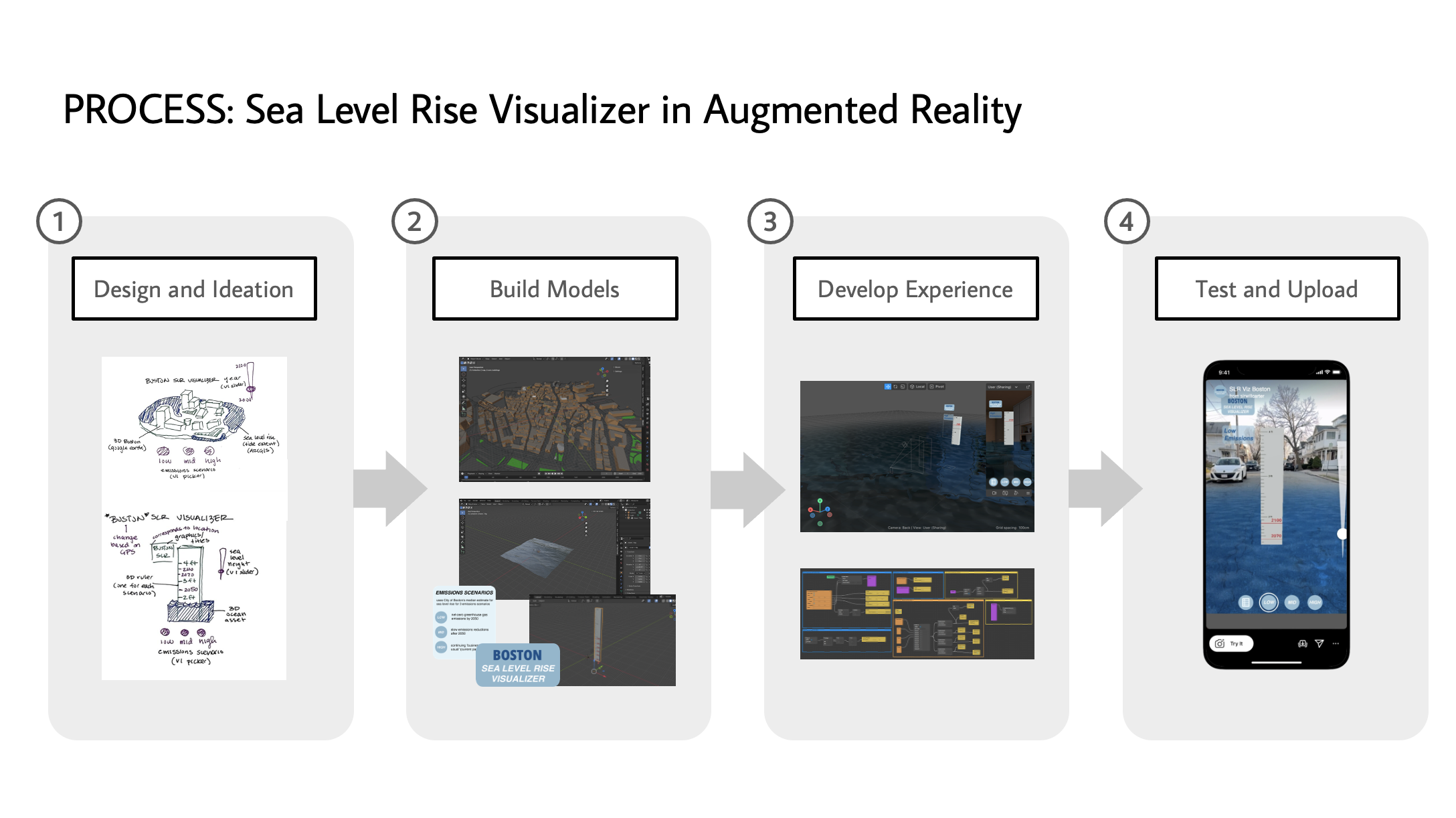
Sea Level Rise Augmented Reality (AR) Flood Visualizer shows flood risk for the greater Boston area, showing potential tideline increases under three different emissions scenarios, geolocated to the user's location
Project was completed as partial fulfillment of Senior Honors Thesis for Tufts University Department of Interdisciplinary Studies for Completion of Self-Created major in Science Communication. Awarded Highest Honors.
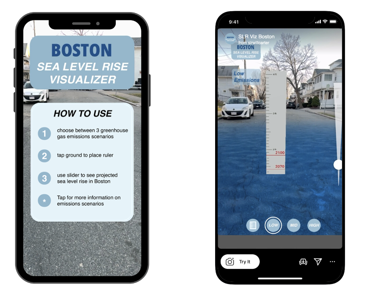
Augmented Reality (AR) filter shows flooding possibilities for 2100 based on a 2000 baseline under low, medium, and high greenhouse gas emissions scenarios as defined under the UN Sustainable Development Goals (SDGs).
The filter is geolocated to the user’s position to provide the most accurate depiction of these flood models.
The project was part of broader stakeholder engagement efforts on how sea-level rise impacts the Boston coastline.
Iterative design workflow showcases development and modeling processes, and how final experience shifted due to user and scientist feedback.